
Mt. Silverheels
Saturday, July 1st
Sandy and Doug made the trip from Durango for the long weekend, and we decided to meet in Fairplay Saturday morning for a hike up Mt. Silverheels, one of Colorado's centennial peaks with a height of 13,822ft. The thought of waking up at 5:00 a.m. wasn't appealing to "The Mistress" so she slept in to rest up for a wedding we had that night. I drove sans radio to Fairplay, and since I had to visit 3 gas stations in Conifer, and directions to the trailhead were wrong, I was a little late. I don't accept any responsibility for this. Derek and Jenn were there as well, although Jenn wasn't going to hike.
I asked Doug if he knew about this creek we had to ford (as per the book), and he gave me a silly look. Apparently he'd manage to read directions to the trailhead, but hadn't read anything about the climb itself. We started hiking up the road, and sure enough after about 5 minutes we came across a creek that was about a foot deep. Although the dogs didn't have any issues with jumping right in, the thought of wading into ice-cold water at 7:30am wasn't appealing to anyone else. I quickly found a small log and hopped across. Sandy went next, and well, wasn't quite as successful. At least she was now on the right side of the creek, albeit with completely wet socks. We sent Doug and Derek back to the cars to get dry socks for Sandy, and they decided to drive across the creek. Sandy and I kept hiking and they caught up to us about 20 minutes later. Sandy now had dry socks, and after a bit of an auspicious start, we continued our trek.
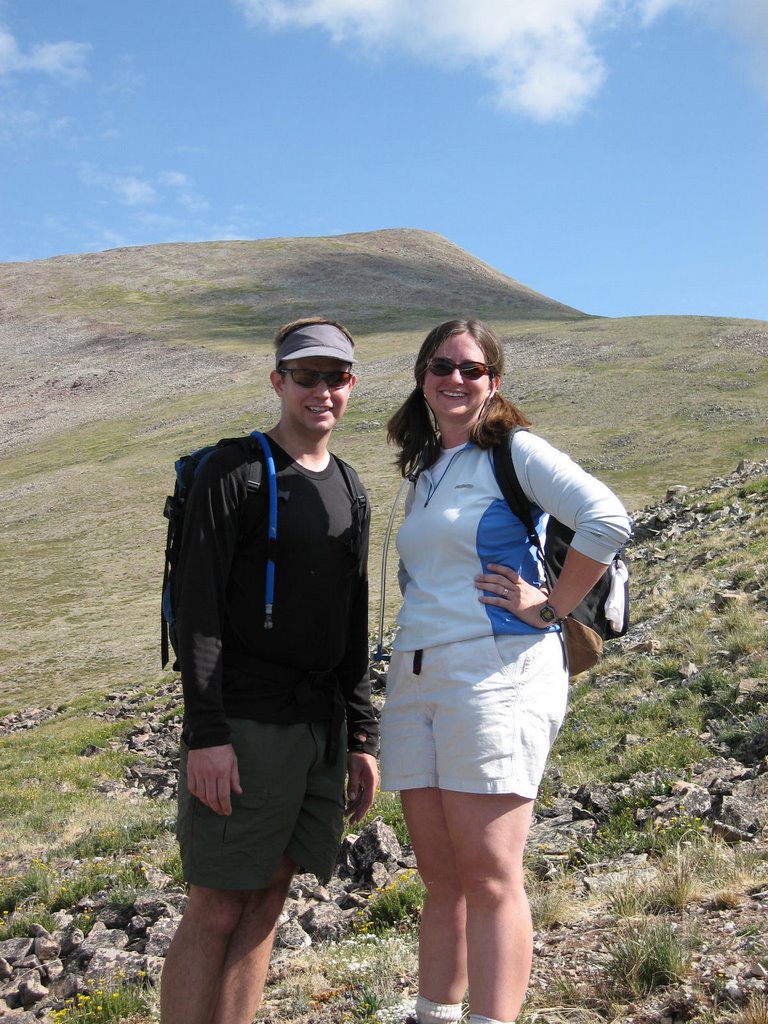
We stopped to check the map, and we were all in agreement that if we got lost it would be Doug's fault. We made it to treeline pretty quickly, and soon the road we were on ended. We hiked up over point 12,252, and we were soon on the grassy slopes on Silverheels south side. The picture of Sandy and I is taken just below 13,000ft, with the summit of Silverheels in the background.
 We were making good time, but I was a little nervous about getting back to Denver for a 4:30 wedding, so I decided to go ahead to the summit by myself. I reached the summit just before 10:30. You can get great views of the entire 10 mile range. I spent about 5 minutes on top, and then started to descend. Doug, Sandy and Derek were only about 15 or 20 minutes behind at this point - they were moving really well!
I tried to find our route up the grassy slopes, but I dropped too far west and had to hike up about 100 feet to catch the road below point 12,252. I reached the road ~40 minutes after leaving the summit, and started to jog. I figured it was only about 1 mile (maybe a little more) down to the main road, and that I would just jog that. Well, I jogged for about 20 minutes and hadn't reached the road. Sometimes going down feels like it takes longer, so I wasn't too concerned. Pretty soon I was jogging through aspens (which I hadn't noticed coming up), and there were tire tracks on the road (the road we came up had been closed). S*%&!! What had I done? At this point I had been jogging for about 30 minutes - probably 2.5 miles. I was heading south when I should have been heading west by this point. I was a little panicked (mostly just perturbed) so I started to head back up the road. At this point I had some idea where I was, but I wasn't completely sure. I was mostly worried that the other 3 would get back to the car and I wouldn't be there.
Did I mention it had started to rain? Anyways, I hiked back up the road, and after about 25 minutes I recognized where I was, and 5 minutes later I was back at the car. Sure enough, Sandy and Doug were there. I guess I took a wrong turn up above treeline at some point and then hooked up with the main road we were originally on. No harm done - I made it back to Denver in time for the wedding, via a very boring (read: no radio) drive home.
Total Time: ~ 5 hours
Total Distance: ~10miles
Total Elevation Gain: 3500ft.
posted by Scott @ 7:50 AM
![]()
<< Home