Thursday, July 20, 2006

Chimney Gulch

Tuesday, July 18th

I met Jennifer, Conrad, and their friend Debbie after work to do Chimney Gulch, which starts just south of the Highway 6/93/58 junction in Golden. The city of Golden's website says 2.5 miles and 2000 feet. Jennifer said 3.5 miles and 1800 feet. I'm going with the latter - as near as I can tell from topozone, the starting elevation is 5800 feet, and the nature center is just under 7600. Based on the time it took, I'd say 3.5 miles is accurate.

The first mile was pretty steep - gaining probably 600+ feet (11%), although it felt much tougher because of the stair-step nature. I think I started off a little too fast, as we did this mile in ~12:30. Ouch. After crossing Lookout Mountain Road, the trail continues to climb steeply on several switchbacks for about ~1/4 mile before becoming more reasonable. I tried to run this steep section, but quickly had to switch to power hiking. At this point Conrad had gotten a gap on me, and I wouldn't catch up with him again until the summit. He said he ran the whole thing - too much for me. I tried to settle into a good pace, but jogging was out of the question for the most part. I made the summit in 51:51, Conrad and I spent a few minutes waiting. At this point it was ~8:15, and we decided to head down.

I did the first mile down in just under 10 minutes, and it started to get dark. We took it easy the next mile and half, and then went really slow the final mile, almost in complete darkness. We made it back to the car just before 9:00 - a total of 1:42 moving.

Total Mileage: 7.0
Total Elevation Gain: 1800ft

Monday, July 17, 2006

Running

Monday, July 17th

With all of my focus on hills, I don't think I've run more than 2 miles continuously in a while. Certainly not last Saturday, when I think the farthest I ran without walking was ~ 2miles. So today I did 3 miles @ 10:54 min/mile pace. I felt pretty good - it wasn't really hard - but for me, running is running, so it's never easy.

Cooked

This is basically how I felt after Mt. Edwards:


Luckily The Mistress and I got massages on Sunday.

Saturday, July 15, 2006

Tour De Edwards

Saturday, July 15th

I went back to try Mt. Edwards again today. The weather was as beautiful today as it was miserable last weekend. I made the decision not to run any of the uphill, just try to hike as fast as I could. The first 6 miles passed smoothly, and I made it to the Waldorf Mine (6.2 miles) in just under 1:35. I turned off the road and headed up the east slopes route. There was no trail to speak of, but luckily the grassy slopes were pretty easy to negotiate and I only had to do minimal bushwacking. There was a snow slope that blocked the direct route up the gully so I traversed north and bypassed it. I was making pretty good time and hit the saddle (13,500ft) in just under an hour since I turned off the road - but I was moving pretty slow at this point. The view of Torreys Peak was spectacular from this point. The Dead Dog Colouir still had a lot of snow in it, but getting up to the snow would be a mess - the runout of the colouir was all scree.

It took a few minutes to climb the ridge to the summit, and I was on top in 2:45. One of my goals was to not stop the entire way to the top, and I accomplished this, although I was moving very slowly the last few hundred feet. I spent a few minutes on the summit - the views were spectacular. I could clearly see Mt. Bierstadt, Mt. Spaulding, and Mt. Evans to the east, Greys, Torreys, and Kelso to the west, and Argentine Peak to the south. I also could see the road coming from Argentine Pass, and it looked like a good way to descend. There was no trail coming up the east slopes route, so I figured if I descended to Argentine Pass, then I could run on the 4x4 road back down to Waldorf Mine.

I spent about 10 minutes on the summit, then made my way down. It was reasonably steep, and I was pretty careful - trying to save a couple of minutes is no reason to risk twisting an ankle. At least not when you're by yourself at 13,500+ ft. I made it to the road and there were several 4x4s, ATVs, and Dirt Bikers at Argentine Pass. I started jogging down the road, although it was ALMOST too steep and too rocky for the speeds at which I like to run. It wasn't the greatest road, lots of rocks and even the smooth sections the road was extremely sloped so I always felt like I was leaning to one side or the other. The real problem was the steady stream of dirt bikes and ATVs.

I got back down to the Waldorf Mine is just over an hour from the summit. All in all I would recommend descending to Argentine Pass - it really does make a nice tour of Mt. Edwards, and since there is no trail on the east slopes route descending the road is probably much easier on one's knees. It was getting hot as I started back down the road to the car. 6.2 miles to go, and another of my goals was to jog the entire way back to the car. I wasn't successful with this one. I jogged for about 20 minutes, started to get a cramp in my side, walked for about 10 minutes, jogged another 15, the alternately walked and jogged (read: mostly walked) the rest of the way down. By the time all was said and done, it took me only 10 minutes less time coming down from Waldorf Mine than going up. ouch!

Total mileage: 17.5
Total elevation gain: 4300 ft.
Total time (w/o stop on the summit): ~ 5:10.

I'll update the exact times later.

Friday, July 14, 2006

Chicago

Wednesday, July 12th

I was in Chicago this week for some work-related training. The hotel I stayed at has an affiliation with one of the local health clubs, Gold Coast Fitness. This place was Swanky (with a capital S). Full court basketball, pilates machines, a kick boxing studio, separate yoga room, day spa, leather chairs with a big screen TV in the locker room - it was over the top. Even the treadmills were super fancy - it was like being in a flight simulator compared to the one at work. Each treadmill even had it's own TV screen with ~75 channels. I usually don't have a problem watching TV while running on a treadmill, but usually the TV is across the room. These little TVs were very hard to get used to - at that close range they appear to be bobbing up and down.

I did 2 minute intervals at grades up to 13%. Also did some slow walking at 15%. Followed off by extended running at 4.5%. Felt pretty good - about 55 minutes, 4+ miles, and ~1200 feet.

Monday, July 10, 2006

Back at it

Monday, July 10th

Less than 2 months until race day. In addition to a planned 2-week tapering period, I've also got a 2-week mandatory rest period scheduled. Maybe to my detriment, I've decided to focus exclusively on hills. Today I did more 5 minute intervals - with usually about 1 minute - 2 minutes of flat in between.

5 mins/7%/5mph (154 ft.)
5 mins/8%/5mph (176 ft.)
5 mins/9%/4.5mph (178 ft)
5 mins/10%/4.5mph (198 ft.)
5 mins/11%/4.2mph (203 ft.)
5 mins/12%/3mph (158 ft.)

Total was just over 4 miles, 1067 ft. I obviously didn't run the last section, and although I didn't cover as much distance, I covered more elevation than running at 7%. I doubt my heart rate was higher than 120bpm for this last section, whereas the first section it was probably around 150bpm.

Triple Crown


Monday, July 3rd

Went to Boulder and finally did the Triple Crown. Sandy did the hike up Green Mountain, and came down Bear Canyon and back to Chatauqau. Doug and I did Green Mountain, then Bear Peak, and South Boulder Peak. By the time we got back on the Mesa trail, it was hot!

We started hiking at about 7:30. Hiking up the amphitheater trail was like hiking in a rain forest - humidity was just about unbearable. It didn't slow us down much, and we made it to Saddle Rock in just about an hour. Sandy was really moving well (although probably annoyed I kept telling her she could "raise her effort level" at certain point - it's nice to know when then trail is going to flatten out). We actually found the trail to the summit this time - I had missed it on my two previous attempts. I now know exactly where I missed it - about 5 minutes after getting on Greenman the trail is traversing west, and there is a rock step that you have to step over to go back southeast. There is a worn out sign on the tree with an arrow, because another (since closed) trail continues west. Seems like an easy mistake to make. :)


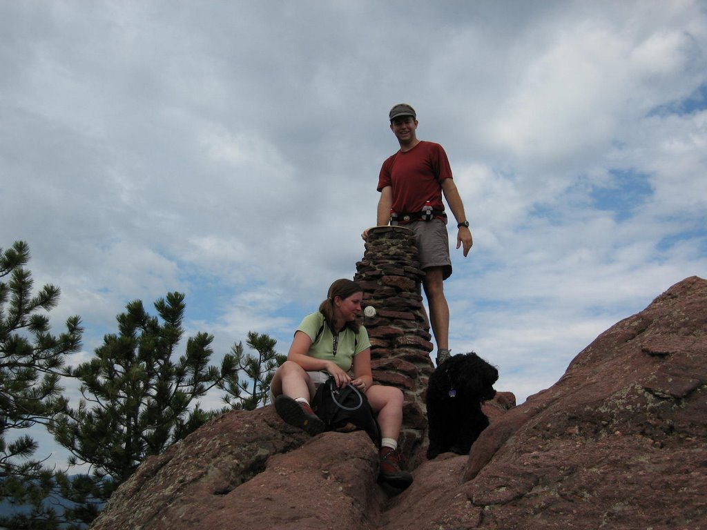
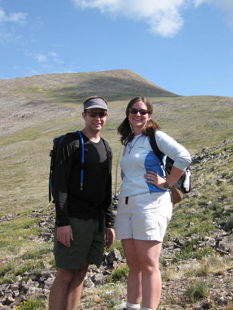
We were on the summit in just over 1:45. Doug snapped some photos, and then we headed down with Sandy to make sure she got on the right trail down Bear Canyon. Doug and I started jogging down the Green-Bear trail, and made the Bear Peak West Ridge trail cutoff in under 10 minutes. I was excited because I had never been on this trail before. It's about 1.8 miles and 1200 feet to the summit of Bear Peak. The trail climbed steeply at first, then kind of rolls along, gently gaining elevation. The last 1/4 mile is steep!! probably gaining 500ft! I was working pretty hard, and I swear the human lung Doug was barely even breathing. We made the summit almost exactly 45 minutes after leaving Sandy. A little slower than I thought - but the trail is pretty long and steep. We spent a few minutes on the summit, and we were feeling pretty good about ourselves, when this girl asked "Are you guys doing the skyline?". We asked her what the skyline was. She replied: "Mt. Sanitas, Flagstaff, Green Mountain, Bear Peak, and South Boulder Peak". We admitted, no, we were only doing Green Mountain, Bear Peak, and South Boulder Peak. She wasn't impressed.

Coming off the summit of Bear Peak I banged my right shin on a really sharp rock. Imagine taking a chisel and hammer and giving a good strong shot right to your shin. It left a hole about 1/4 inch deep, and started to swell up. I was worried it would get worse, but it didn't cause me any problems. However, a week later and it's still a little swollen and I'll probably have a nice deep scar.

We made the summit of South Boulder Peak, and started the descent down Shadow Canyon. This is nearly as steep as Fern Canyon, but much nicer because there are no loose rocks and dirt. As soon as we hit the mesa trail it was hot!! At this point we still had 5+ miles to go. We jogged all of the flats and downhills and hiked the uphills (there are at least 4 or 5 sections between Shadow Canyon and Chatauqau). I was pretty cooked by the time we got past NCAR. I managed to jog the last 1.5 miles, and ended up walking down the final road. It took us longer than I thought it would (go figure) and Sandy had been waiting for about an hour. All in all, it was a great day - and it capped off a six day stretch where I did approximately 35 miles and 12,000 feet of elevation gain.

Here are the approximate times (splits in parantheses):

Green Mountain Summit: 1.48
Green-Bear Cutoff: 2.08.12
Bear Peak West Ridge: 2.17.49 (9.37)
Bear Peak Summit: 2.55.27 (37.38)
Leave Bear Peak: 2.59.05 (3.38)
Top of South Boulder Peak: 3.15.33 (16.28)
Return to Saddle: 3.24.47 (9.14)
Shadow Canyon descent: 3.49.47 (25.00)
Chautauqau: 5.02.48 (1.13.01)

Total: ~13 miles, 4500ft.

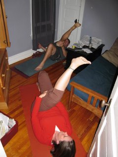
Cool down stretch at the yoga room of Hotel 4048:

Saturday, July 08, 2006

Rain, Rain Go Away

Saturday, July 8th

Drove up to Georgetown this morning and headed up Mt. Edwards via the East Slopes route from the Leavenworth Creek Trailhead. Of course, it started raining right as I pulled into Georgetown, and didn't stop all morning. Hmmm, Molly and I aren't having a bbq tonight - why the rain?

I decided to start up the road to Waldorf Mine in the rain. The road climbs steeply (~10%) for the first mile, then joins an old railroad grade (that used to run from Silver Plume) all the way to Waldorf Mine. After 45 minutes I was pretty soaked, so I turned around, and jogged back down. Did about 6 miles, 1 hour 15minutes.

Update: We got 1.7 inches of rain over the weekend - that brings the total for the year to 3.79 inches!! The yearly total almost doubled in one weekend - crazy! We also got enough rain that it apparently seeped into our basement right beneath the stairs - no other place though.

Thursday, July 06, 2006

12%

Thursday, June 6th

Turns out the treadmill at work only goes up to a 12% incline. I know the one at the Ashland Rec Center goes up to 15%. I decided to do some steeper walking today - did 2 miles at 12%, at varying speeds between 15:00min/mile and 20:00min/mile. My heart rate felt fine, but my legs felt like I was walking with cinder blocks attached. My calves really stiffened up. I guess the constant grade is a lot different than the typical stair steps that I've been getting on some of the steeper hikes.

Overall it took me ~35 minutes to do the 2 miles. About 1250ft of elevation gain.

Trying to catch up

Wednesday, June 5th

We had a big weekend - Mt. Silverheels on Saturday and long hike/run through the flatirons on Monday. I've been busy at work so I haven't had time to write these up - I'll do so soon. I'm also waiting on pictures.

Today I was back on the treadmill.

Did a total of 2 miles @ 7%, 12:00min/mile. Did the first 20 minutes, then walked for two minutes, and finished the other four minutes. This was a pretty tough effort. I felt like I was just over the level at which I was comfortable sustaining a long-term effort. I kept telling myself - "OK - just do 1 mile. OK, 15 minutes. OK - just 5 more minutes". I finally had to rest after 20 minutes, but I felt good because my previous sustained effort running uphill was 20 minutes @ 6%. It's amazing how hard a small increase feels.

After running I did some fast-walking at steeper grades, eventually ending with 4 mins @ 15%. Then I finished off with some flat running at 10:00min/mile pace. All total I did 3.5 miles, 45 minutes, and a little over 1000 vertical feet.

Sunday, July 02, 2006

Mt. Silverheels

Saturday, July 1st

Sandy and Doug made the trip from Durango for the long weekend, and we decided to meet in Fairplay Saturday morning for a hike up Mt. Silverheels, one of Colorado's centennial peaks with a height of 13,822ft. The thought of waking up at 5:00 a.m. wasn't appealing to "The Mistress" so she slept in to rest up for a wedding we had that night. I drove sans radio to Fairplay, and since I had to visit 3 gas stations in Conifer, and directions to the trailhead were wrong, I was a little late. I don't accept any responsibility for this. Derek and Jenn were there as well, although Jenn wasn't going to hike.

I asked Doug if he knew about this creek we had to ford (as per the book), and he gave me a silly look. Apparently he'd manage to read directions to the trailhead, but hadn't read anything about the climb itself. We started hiking up the road, and sure enough after about 5 minutes we came across a creek that was about a foot deep. Although the dogs didn't have any issues with jumping right in, the thought of wading into ice-cold water at 7:30am wasn't appealing to anyone else. I quickly found a small log and hopped across. Sandy went next, and well, wasn't quite as successful. At least she was now on the right side of the creek, albeit with completely wet socks. We sent Doug and Derek back to the cars to get dry socks for Sandy, and they decided to drive across the creek. Sandy and I kept hiking and they caught up to us about 20 minutes later. Sandy now had dry socks, and after a bit of an auspicious start, we continued our trek.

We stopped to check the map, and we were all in agreement that if we got lost it would be Doug's fault. We made it to treeline pretty quickly, and soon the road we were on ended. We hiked up over point 12,252, and we were soon on the grassy slopes on Silverheels south side. The picture of Sandy and I is taken just below 13,000ft, with the summit of Silverheels in the background.

We were making good time, but I was a little nervous about getting back to Denver for a 4:30 wedding, so I decided to go ahead to the summit by myself. I reached the summit just before 10:30. You can get great views of the entire 10 mile range. I spent about 5 minutes on top, and then started to descend. Doug, Sandy and Derek were only about 15 or 20 minutes behind at this point - they were moving really well!

I tried to find our route up the grassy slopes, but I dropped too far west and had to hike up about 100 feet to catch the road below point 12,252. I reached the road ~40 minutes after leaving the summit, and started to jog. I figured it was only about 1 mile (maybe a little more) down to the main road, and that I would just jog that. Well, I jogged for about 20 minutes and hadn't reached the road. Sometimes going down feels like it takes longer, so I wasn't too concerned. Pretty soon I was jogging through aspens (which I hadn't noticed coming up), and there were tire tracks on the road (the road we came up had been closed). S*%&!! What had I done? At this point I had been jogging for about 30 minutes - probably 2.5 miles. I was heading south when I should have been heading west by this point. I was a little panicked (mostly just perturbed) so I started to head back up the road. At this point I had some idea where I was, but I wasn't completely sure. I was mostly worried that the other 3 would get back to the car and I wouldn't be there.

Did I mention it had started to rain? Anyways, I hiked back up the road, and after about 25 minutes I recognized where I was, and 5 minutes later I was back at the car. Sure enough, Sandy and Doug were there. I guess I took a wrong turn up above treeline at some point and then hooked up with the main road we were originally on. No harm done - I made it back to Denver in time for the wedding, via a very boring (read: no radio) drive home.

Total Time: ~ 5 hours
Total Distance: ~10miles
Total Elevation Gain: 3500ft.